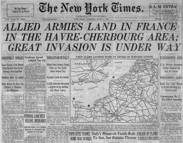
New York Times Front Page from June 6, 1944 with
Breaking News of the Long-Awaited Invasion of European Continent
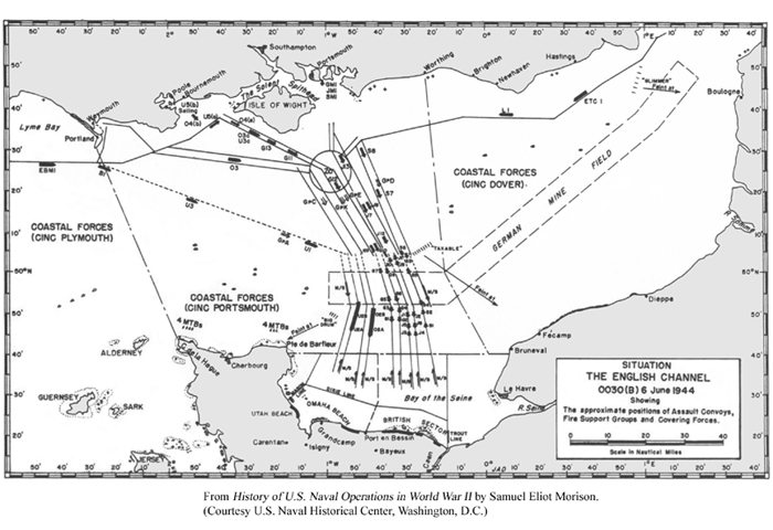
BELOW: Chart of Invasion Assault Routes in the English Channel
from Southern England to Normandy, France.
New York Times Front Page from June 6, 1944 with
Breaking News of the Long-Awaited Invasion of European Continent
BELOW: Chart of Invasion Assault Routes in the English Channel
from Southern England to Normandy, France.
(Detailed
explanation of charts / maps below.)
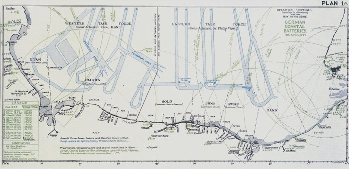
BELOW:
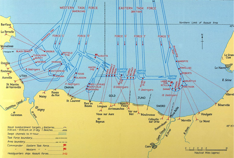
Operation Neptune Landing in Normandy
D-Day Invasion Beaches - Utah, Omaha, Gold, Juno, Sword
(more maps below)
|
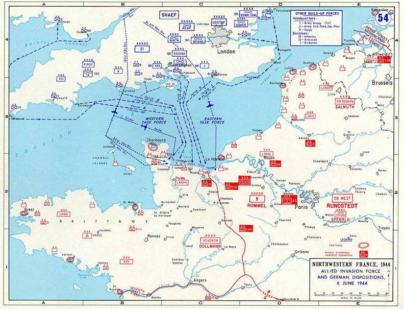
OVERVIEW - THE ALLIED
INVASION OF OCCUPIED EUROPE
Adolf Hitler was a madman who had to be stopped. Before June 1944, most of Europe was occupied and controlled by German forces. Until an invasion of the continent, Hitler would maintain his tyrannical grip, ever seeking to fortify himself in his quest for world domination. To attack Hitler and his Third Reich, a vast armada of ships was required to escort troops; haul the necessary equipment, supplies and support staff; and bombard the shore in support of the invading forces. Under General Eisenhower’s command, the place chosen to enter Europe by force was on the coast of France in the English Channel — a region called Normandy, along which Hitler had constructed his widespread shoreline of defense, declaring it his impenetrable Atlantic Wall. The entire Normandy Invasion plan, code named Operation Overlord, would involve paratrooper and glider assault, air bombardment, naval bombardment, and infantry beach assault. The colossal part the navy played in the invasion was called Operation Neptune. In early June 1944, the largest naval attack force in history consisting of more than 5,000 ships was assembled in southern England, ready to invade Normandy. Originally planned for June 5 but postponed 24 hours due to bad weather, the invasion that was the beginning of the end for Adolf Hitler occurred on D-Day, June 6, 1944. Along the coast of Normandy were five continuous stretches of shoreline to be invaded, each several miles long. Two lanes were cleared across the English Channel to each of the five invasion beaches, for a total of 10 assault routes. The convoys destined for Utah Beach had lanes 1 and 2. Omaha Beach had lanes 3 and 4, Gold Beach had 5 and 6; Juno, 7 and 8, and Sword Beach had lanes 9 and 10. To get to their assault beaches about 100 miles away, the American forces, which had the farthest to travel, would head out first into the English Channel. The British and Canadian forces would rendezvous along side the American convoys at a pre-designated area in the Channel. A few ships of French, Dutch, Polish, Greek, and Norwegian nationality also sailed in the armada. In addition to American, British, and Canadian troops, lesser numbers of French and Polish troops took part in the assault. Paratroopers and glider troops would touch down inland before dawn on D-Day to attack key enemy positions and secure critical areas. Allied bombers would provide steady bombardment of enemy targets along the shore as well. At about first light, navy warships would provide drenching bombardment of enemy artillery batteries and strongpoints on and near the shore. Then would come the intense beach assault by infantry troops, aided by naval gunfire. The British would attack two beaches code-named Gold and Sword; Canadian forces would land on Juno Beach; and American forces would invade the two beaches code-named Omaha and Utah. Altogether, 160,000 troops would land at Normandy on D-Day. The objective of D-Day was to get as many troops ashore and inland as fast as possible. |