USS Corry
(DD-463) Army Map and Navy-Army "Chart-Map" with grid
lines
1st Map: US Army Pre-D-Day Map showing Utah Beach Artillery Batteries
2nd "Chart-Map" showing batteries and strongpoints
with grid lines overlay for close-up determining of
coordinates.
KEY: How to
read numbers in lower left corner of 1st map.
Example: The map entry for Target 15 is as follows:
Target Grid # Barrels MM
Type Range (yards)
15 342102
4 150
H 14600
Note: 1st Map shows Target 3 (St-Marcouf/Crisbecq) originally having six 155mm
guns.
However, those guns were moved and three 210mm guns were installed at Target
3. The 210-mm guns had a range of 32,800 yards -- 18.5 miles -- and they
fired on the
USS Corry at less than 3 miles --
virtually
point-blank
range.
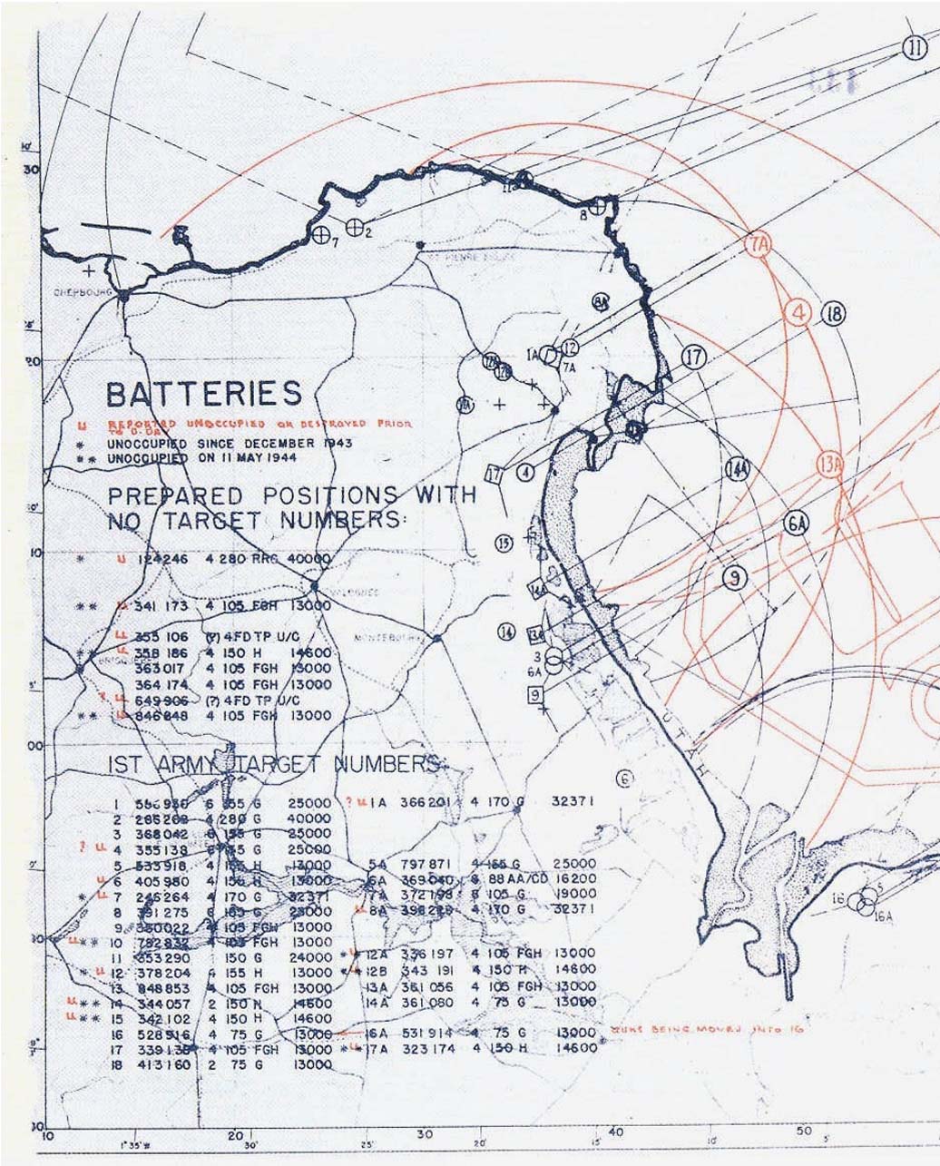
Above: US Army Pre-D-Day Map of Utah Beach Artillery Batteries
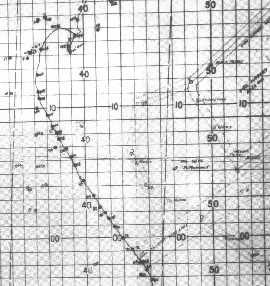
Above: "Chart-Map" showing batteries and strongpoints
with grid lines overlay for close-up determining of coordinates.
Source: Grid chart-map from USS Quincy (CA-71)
Action Report. Serial 008. 29 June 1944.
(National Archives)
USS Corry DD-463 home page